Somerville Greenway a Key Part of Metro Boston's Rich Mobility Network

The Metro Boston area thrives in a geographic space with very marked and distinctive four seasons. This quality provides a diversity of destinations for recreation activities year-round, but it also determines how people travel from the places where they live to those where they work, study, recreate, and shop.
Versatile Greenways Offer Multiple Benefits
There are different types of mobility infrastructure, from highways to paths, depending on the purpose. However, for those who like to move locally in human-powered vehicles or just by putting their feet in motion, the region's network of greenways offers access and choice.
A greenway is an off-road multimodal path that offers transportation, recreation, and ecological services at the same time. The metro Boston Area has several greenways, with different lengths and characteristics. One particularly interesting path among the interurban sections is the Somerville Community Path. This 2-mile path runs between Lowell Street in Somerville and Cameron Avenue where, upon entering Cambridge, becomes the Alewife Linear Park.

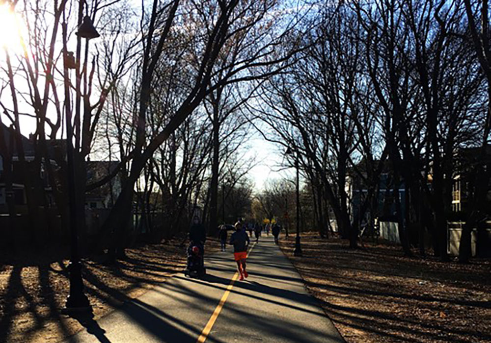
Multiple mobilities in the path. Photo by María de la Luz Lobos 2020.

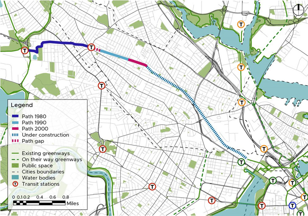
Map of the Alewife Linear Park and Somerville Community Path in context. Credit María de la Luz Lobos 2021.
Somerville's Vibrant Interurban Greenway Fosters Community
More than a community path, the section in Somerville is an interurban greenway. Unlike many Boston Area greenways that run along the edges of water bodies, this path passes through the urban fabric, creating a linear park in between existing buildings, including houses. This is not a coincidence. According to the records of the Cambridge Community Development Department, the Massachusetts Bay Transportation Authority (MBTA) in the 1980s built the extension of the Metro Red Line underground, leaving the space for the path to be built on top of it.
As a multimodal path, it provides both mobility and recreation alternatives that are safe and pleasant. For a pedestrian, it offers the shade of trees rather than the sidewalk heat. A person on a mobility device may prefer the smooth asphalt over a cracked sidewalk, and a bicyclist might choose the wide path overriding side by side with cars on an unprotected bike lane.
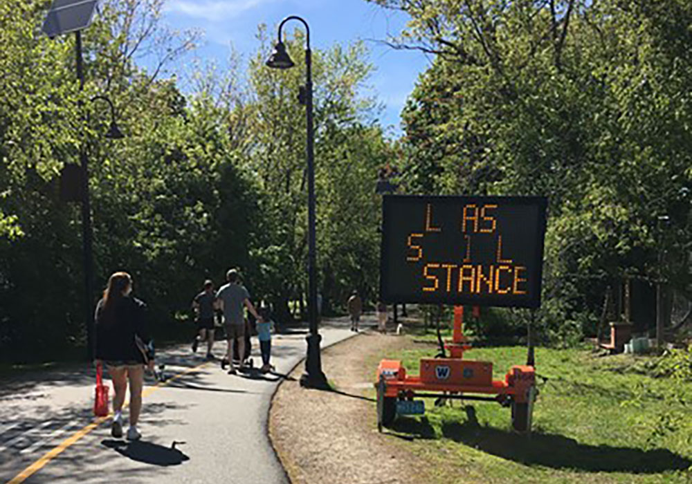
The paved path is about 14.5 feet wide — which fits the Massachusetts transportation standards for a bidirectional shared path — but the width of the park itself varies, having on average 50 feet of linear space available. This quality has made the path a preferred choice for recreation over the pandemic because it provides a safe outdoor activity space and plenty of room for remaining six feet from other users.
This path is very popular at all times of day and all year long. Bicyclists love it, especially in the winter, when they tend to be pushed to share the road with drivers because many of the bike lanes are covered in snow or ice. After all, municipalities fail to plow properly (some main roads have signs that say "bike may share the road"). Over the summer, greenways like Somerville's are particularly busy, and walkers, runners, cyclists, and other micromobility users need to coordinate to share the same space while traveling at different speeds.

Light sign "Please social distance," at the beginning of the pandemic. Photo by María de la Luz Lobos 2020.

Path in the Fall, by Scott Penman 2020; Path in the Winter by María de la Luz Lobos 2021; Path in the Summer by María de la Luz Lobos 2020.
Greenways Enhance Urban Mobility in Metro Boston
In a place like Metro Boston, people have many options for urban mobility, and may also combine more than one in the same trip seamlessly. The path offers the option to travel more safely by avoiding clashes with other transportation users like buses and automobiles. A comprehensive and connected network of greenways and shared paths, like that envisioned by the Emerald Network, can amplify those benefits.
The Somerville Community Path does have a missing link between Grove and Holland streets, on the way to the iconic Davis Square. The Davis Square area encompasses multiple stores and restaurants, and it's the point where four Somerville main roads come together. It also has two entrances into the underground T and connects to 6 bus lines. With so many different urban layers, there is a section where the path disappears. Looking at the map, one can infer a line that connects both branches of the path, but in reality, that space is clogged by a busway where buses wait to be boarded by people coming from the Davis Square T-station, pushing pedestrians onto the sidewalk and bicyclists onto a busy roadway. This is a planning conundrum. It's worth thinking about spatial solutions that can be put in place to have a continuous path while still providing space for the other vital transportation options that come together there.
According to Boston Globe records, the path originally existed between Alewife and Davis Square. In the 1990s it was extended into Cedar Street, and in 2014 it reached Lowell Street. This last section is part of an ongoing project to extend the Green Line at the Lechmere light rail station in East Cambridge. The path could travel alongside the Green Line, allowing for multimodal transportation choices along the east branch of the Somerville Community Path. It is a great example of making a planning effort count by combining a transit improvement with new infrastructure that allows multiple mobility options in the near spaces.
Public and community support has been critical in achieving these path extensions and the creation of this asset. The Friends of the Community Path have been advocating for this space for about 20 years, proving that when the community and decision-makers work together, it's a benefit for all.
The Somerville Community Path and the Alewife Linear Park are an example of the different virtues of a greenway, providing multiple services for both the local and outer community. Once the extension is completed, it will turn into one of the main off-road network connections of the area, providing a comfortable, enjoyable, and safe option for multiple people to move around the cities of Somerville and Cambridge and connect to other destinations beyond those limits.
Top Image: Somerville community path. Wikimedia Commons photo by Monika M. Wahi (CC BY-SA 3.0).


