Governor Tom McCall Waterfront Park: Portland, Oregon

Summary
Catalyzing the revival of the Portland, Oregon, riverfront, Governor Tom McCall Waterfront Park is a hallmark of the city's storied planning tradition. The park was born out of Gov. Tom McCall's 1968 Harbor Drive Task Force, which called for the closure of Harbor Drive Freeway and a return to the pedestrian-oriented principles laid out in 1903 by the Olmsted Brothers in their park plan. Since 1978, the 30-acre park has served as a green urban greeting to residents and visitors alike. The park was developed in five phases, ending in 1989.
Designated Area
Park fronts Willamette River between Naito Parkway to the west; Northwest Glisan Street to the north; and Southwest Harrison Street to the south.

The park's cherry trees in full bloom. Courtesy Portland Parks and Recreation.
Planning Excellence
More than just a green corridor through the city, the park's design includes a diverse range of features, from the Battleship Oregon memorial to 100 cherry blossom trees surrounding the Japanese–American Historical Plaza. In addition to attracting hundreds of daily users for recreation and relaxation, events like the quirky Saturday Market and June Rose Festival bring nearly one million people to the park each year.
Recommendations for the future of the park were developed during a master plan update completed in 2003. The 30-month process generated a 20-year strategic plan that focuses on accommodating increased recreational activity along the riverfront. Several features of the master plan, including an interactive water play area that became a reality in the Bill Naito Legacy Fountain, have been implemented.
New development inspired by and located next to the park includes RiverPlace. The first phase, finished in 1985, included a marina, condominiums, a hotel, restaurants, and an office building. Later phases followed, adding townhouse units, an athletic club, and retail and restaurant space.

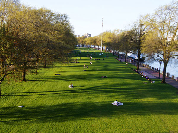
The park's central lawn area. Other features of this 30-acre park include fountains, sculptures, and connecting paths and walkways. Courtesy Portland Parks and Recreation.
Defining Characteristics, Features
History
- Olmsted Report (1903) and Bennett Plan (1912) emphasize need for urban greenway to preserve Willamette riverfront
- Thirty-two foot high, $2.7 million seawall built along river to stem flooding (1929)
- Construction of 1943 Harbor Drive Freeway restricted pedestrian access to riverfront
- Oregon State Highway Department proposed Harbor Drive expansion; Oregon Governor Tom McCall halted expansion and called for a waterfront park (1968)
- Harbor Drive permanently closed in 1974; architecture firm Wolff Zimmer Gunsul Frasca drafts $20 million Downtown Waterfront Park Master Plan (1975)
- After 1978 park opening, a 1982 management study implemented changes to oversee booming park usage
- Park renamed for Oregon Governor Tom McCall (1984)
- Master Plan updated in 2003; 15- to 20-year plan includes expansion of Saturday Market hardscape and landscape improvements
Design features
- Architect Robert Perron's Salmon Street Springs (1988) and Bill Naito Legacy Fountain (2009), named for Portland civic leader, provide interactive waterworks
- Tree-lined Central Lawn provides open space for events hosting, such as July Waterfront Blues Festival and Portland Brewers Festival
- Sculptor Lee Kelly's Friendship Circle features two 20-foot steel towers protruding from base, playing electronic music by composer Michael Stirling
- Founder's Stone, honoring Portland founders William Pettygrove and Asa Lovejoy, provides historical context for all of downtown Portland
- Architect Robert Murase's Japanese–American Historical Plaza features Japanese art and sculptor Jim Gion's Songs of Innocence, Songs of Experience
Citizen engagement
- Downtown Plan Citizen Advisory Committee, composed of 18 private citizens, propose creation of tax increment-funded Waterfront Urban Renewal District (1972)
- Riverfront for People, founded by Allison and Bob Belcher and Jim Howell in 1969, has fought for public access to the Willamette River waterfront for more than 40 years
- Citizen-based research organization Portland City Club conducts civic salons and publishes reports, including 1969 analysis calling for creation of waterfront park
- Waterfront Park Master Plan updated from 2000-2003 through citizen workshops, surveys, and public meetings with attendance averaging 500 people

Development of the park entailed closing Harbor Drive and replacing it with a promenade along the Willamette River. Courtesy Portland Parks and Recreation.


