Planning August/September 2019
The Falling Dominoes of Climate Change
Natural disasters aren’t always one-off events. Cascading hazards require a different approach to resiliency.
By Brian Barth
California's recent epic drought, thought to be the worst in at least 1,200 years, produced one of the state's worst-ever fire seasons in 2017, which culminated with the Thomas Fire in Southern California — at the time the largest fire in the state's recorded history.
The Thomas Fire was unusual in that it began in December, normally the rainy season, and burned well into January. Just as firefighters were getting the blaze under control, a massive storm blew in from the Pacific, dousing the region in monsoon-like rains. Around 3:30 a.m. on January 9, a half-inch of rain fell in a five-minute period on the fire-charred hills above the town of Montecito, in Santa Barbara County; within 15 minutes, an inch of water had dropped. Slopes baked and denuded by fire are notoriously unstable, and by 4 a.m., mud, boulders, uprooted trees, and other debris coursed through residential neighborhoods in a torrent up to 25 feet deep and moving at up to 25 miles per hour.
Twenty-three people died in the Montecito debris flows, including two children whose bodies have never been recovered. Climate change was certainly one culprit in the disaster. But local planning and zoning codes may have been a contributing factor.
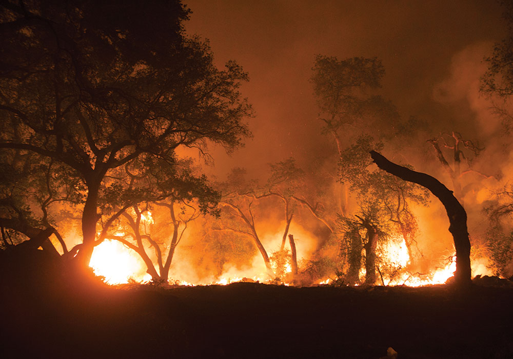
Flames from the Thomas Fire as they approach Santa Paula, near Highway 150 in Southern California. JPhilipson/iStock/Getty Images Plus.
"It's time to get serious about landslide zoning," wrote geomorphologist David Montgomery on the website The Conversation in an op-ed after the Montecito disaster. The domino effects of forest fire, flooding rains, and mudslides in the West are well documented. It is hard to predict exactly where debris flows will occur, though by nature they generally occur somewhere within "alluvial fans" — landforms at the base of steep mountain ranges where a stream basin has for millennia channeled hunks of land from unstable upslope areas, spreading the earth out below in broad, gently sloping foothill areas — which are often popular locations for development.
"There are reasons why people keep building homes in landslide-prone areas," explains Montgomery, noting that in mountain-adjacent communities "slide-prone slopes tend to offer the best, and most expensive, views." But he doesn't blame home owners, or even developers. "The threat to Montecito was clear. Scientists and planners have known for decades that the mountains of Southern California are shaped by a cycle of fire, rain and debris flows. ... I suspect that many Americans living in landslide country are simply unaware of potential hazards that the lay of the land presents to their homes, neighborhoods, and businesses."
In one example of landslide-conscious planning, officials in Rancho Cucamonga, a city nestled in the sprawling suburbs of Los Angeles, restricted development to the periphery of a local alluvial fan known as the San Sevaine Wash, designating it as green space and reinforcing the edges to prevent debris flows from spilling over into nearby subdivisions.
But this pattern of development is more an exception than the rule. Following a 2003 mudslide that killed 16 people in San Bernardino, the California Legislature formed an Alluvial Fan Task Force to come up with recommendations for balancing development pressure — which steadily pushes out from the state's urban areas into the lower slopes of nearby mountain ranges where alluvial fans are often found — with public safety. The task force found that between 2000 and 2006, more than 500,000 new development projects were approved in alluvial fan areas. The group produced a model alluvial fan ordinance, but as of January 2018, according to E&E News, no county or municipality in the state had adopted it.
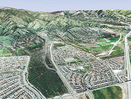
Rancho Cucamonga, California, restricts development to the periphery of the San Sevaine Wash at the foot San Gabriel Mountains. Photo courtesy Esri ArcGis Explorer, Alluvial Task Force/California State University, Santa Barbara.
Cascading hazards and climate change
The drought-fire-landslide scenario is one example of what emergency management professionals and others increasingly refer to as cascading hazards. Other examples of cascading hazards abound, often with interwoven natural and human-made components: a flood that damages a wastewater treatment facility or a chemical plant, creating a health hazard as contaminated waters spread throughout the community; hurricanes that destroy oil and gas infrastructure, causing prices at the pump to spike; a drought that destroys agricultural livelihoods, causing mass migration and political unrest.
To varying extents, all disasters have knock-on effects. That's part of what constitutes a disaster. But there seems to be an increase in cascading and back-to-back disasters in recent years that have left communities, at least in certain parts of the country, struggling to rebound.
Residents of Louisiana were still in a state of shock from Hurricane Katrina when Rita hit in the summer of 2005. Ditto with Hurricanes Irma and Maria in Puerto Rico in 2017. Extreme heat waves lasting a week or more that coincide with droughts are twice as common in the U.S. as they were 50 years ago.
In the same period, fires in Southern California have become more frequent and severe. Nationally, the area burned by large fires grew an average of 90,000 acres per year between 1984 and 2011, when the burns that scientists attributed to anthropogenic global warming roughly doubled. The Thomas Fire that preceded the Montecito disaster was the biggest on the record books at the time, but it was quickly replaced by the enormous Mendocino Complex Fire in the summer of 2018, the most destructive year in the state's firefighting history.
In terms of economic impacts, 2017 was the costliest year on record for natural disasters in the U.S., and the four most costly years have all occurred since the turn of the millennium. The pattern has not let up in 2019, with widespread flooding and an unprecedented number of tornadoes pummeling the Midwest as I write this.
These trends have caused disaster preparedness to move beyond the purview of emergency management professionals and into the world of everyday land-use planning decisions. The slow, difficult work of planning for cascading hazards falls into two broad buckets: applying zoning and other land-use controls to prevent development in vulnerable locations and establishing safety nets for at-risk communities so that they are more resilient when disaster strikes. Put another way: mitigation and adaptation.
One Triggering Event, Many Hazards
Local data defines the interdependencies between hazards in a defined area after a triggering event and the probability that cascading disasters will result. Hazard "trees" showing their relationships can help develop timelines and guide decision making and plans. Here, the matrix plots the cascading effects after a volcanic eruption on the Greek island of Santorini.

Source: International Journal of Disaster Risk Reduction
"Where the rubber meets the road with any kind of hazard event is land use," says Shannon Burke, manager of APA's Hazards Planning Center, which will soon produce a guidebook titled Drought Mitigation Planning in a Multi-Hazards Context. "In other words, there are places where humans maybe shouldn't be. And if they are already there, maybe they should take steps to reduce the risk, like elevate their homes or purchase flood insurance."
Burke acknowledges that this is easier to preach than it is to practice. The country is full of homes built in floodplains, which are growing in size as FEMA revises its flood maps. Buyout programs are theoretically an option for the most flood-prone homes, but the same cannot be said for fire- or slide-prone homes. Many jurisdictions around the country are requiring, or at least incentivizing, owners of flood-prone structures to raise them.
But Burke, who is from Louisiana, where it is not uncommon to see houses standing on 10-foot stilts near the coast, notes that this makes them vulnerable to another hazard. "The higher you elevate a home, the more it can be impacted by wind," she says. "The key is to look at this holistically — not as floods being one hazard and wind being another — and consider how these things interact."
Cody Knutson, the planning coordinator at the National Drought Mitigation Center, explains that a number of specialized fields of disaster planning have developed in recent decades — drought planning, flood planning, fire planning, earthquake planning, and more — but that multi-hazard planning is a rare expertise. "Hazard planners have traditionally dealt with their own hazards separately, but just recently this idea of cascading hazards has been popping up. It's kind of a novel concept, but it shouldn't be."
Instead of separate hazard plans, he suggests a "multi-hazard" or "all-hazards" plan as a way to improve local resiliency and reduce redundant planning efforts. In smaller communities where planning resources may be highly constrained, he suggests an approach that might be termed "integrated hazards planning," in which comprehensive plans and other existing plans adequately address each hazard that the community is vulnerable to.
Above all, says Knutson, don't assume that past conditions are a reliable predictor of future hazards. "It used to be with hazard mitigation planning that we focused on what happened in the past as the basis for going ahead. We need to enhance that with future climate adaptation as well — not only what happened in the past, but what are some likely scenarios in the future."
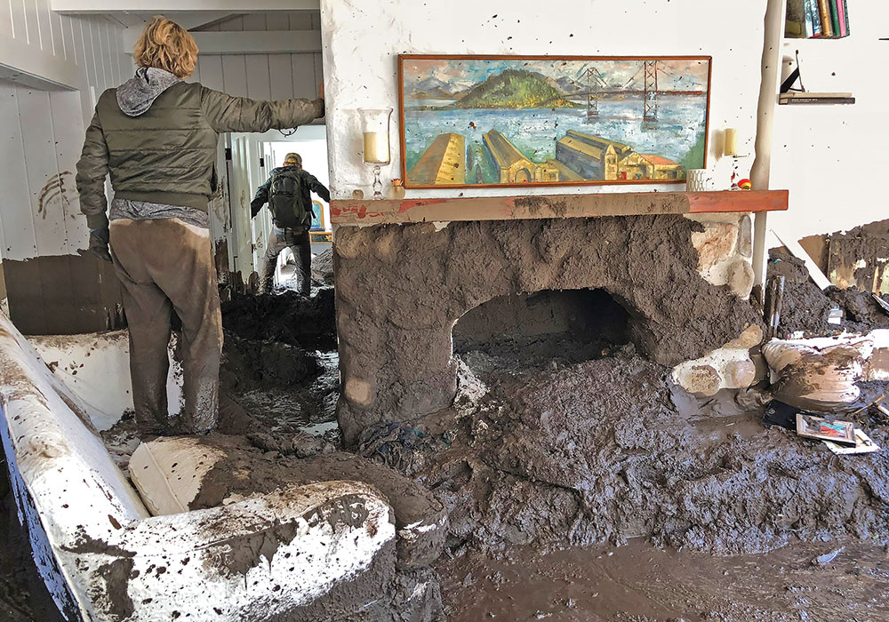
Relatives of Montecito resident Rebecca Riskin search for her belongings in her mud-filled living room. Riskin and her husband were swept away the morning of January 9, 2018, by the debris and boulder-filled San Ysidro Creek. Riskin's body was found later; her husband was rescued by helicopter. Photo by Mike Eliason/Santa Barbara County Fire Department.
Montecito mud
Montecito, a community with a disproportionate number of multimillion-dollar homes (Oprah Winfrey and Ellen DeGeneres are among its residents), provides a window into the difficulties of balancing property rights with public safety. With the slopes above it still recovering from wildfire, the community remains at high risk for additional mudslides. Yet residents are clamoring to rebuild, mirroring an intense debate occurring across the country over what restrictions, if any, should be put into place regarding how post-disaster rebuilding occurs.
In Montecito, officials have greatly expanded the designated "high-hazard areas," which now cover about half the community. In these zones, the county now requires homes to be rebuilt two feet higher than the base flood elevations, which are themselves newly elevated based on a revised 100-year flood scenario. With 100- and 500-year floods occurring more regularly of late, this is perhaps of limited consolation. In what locals have come to call the "red zone" — the areas of highest risk on the county hazard map — home values have declined 25 percent since the disaster.
Given the housing crunch in California, however, there is little appetite to discourage rebuilding, or to prevent new development, in fire and mudslide-prone locations. An annual fee to help offset the state's firefighting costs was imposed on home owners in high-risk areas in 2011, but was nixed in 2017 due to public opposition.
Similar property rights struggles have occurred elsewhere in the nation. A state program to map landslide risk in the mountains of North Carolina was scrapped in 2011, in part due to opposition from real estate groups; a legislative proposal to prevent development on slopes greater than 40 percent never got off the table. In Montana, the Lewis and Clark Rural Fire Council received hate mail after declaring in 2013 that it could no longer bear the cost of protecting homes in the "wildland-urban interface."
Such is the climate within which wildfire planners like Molly Mowery, AICP, work. Mowery, who conducts public engagement efforts for a nonprofit group called Community Planning Assistance for Wildfire (she also is the coauthor of a recent PAS Report, developed with funding from the USDA Forest Service, called Planning the Wildland-Urban Interface), says education is key.
Encouraging communities to build up instead of out can go a long way in mitigating future risk, as urban cores tend to be built on relatively safe ground and the cost of any mitigation efforts that are required can be split among many taxpayers. Yet it's difficult to convince someone who has saved for years to build their dream home on an awe-inspiring, but fire-prone, ridgetop outside town that there are societal costs to even one house going up.
"When planners make decisions to allow homes on a hillside, you can no longer manage that area in the same way for fire prevention," says Mowery. Prescribed burning and clear-cutting to create fire breaks, two of the main approaches to wildfire prevention, are not very feasible within a sprawling community of ranchettes, for example. Yet the local fire jurisdiction is still obligated to protect those homes. "Even if home owners do a wonderful job clearing debris and other potential fuels from around their property, there's a limit to how much you can do at a landscape scale with structures embedded in that landscape. It sets up a really difficult dynamic."
Her advice to planners seeking to become more conversant in the cascading hazards issue is to talk to local first responders. She once interviewed firefighters who'd fought a blaze together in a Colorado community. The group said they thought they had a sense of where the homes were — and felt optimistic they could save them — but became panicked when they realized how much development had recently occurred. "When I turned around and saw all of these homes on the hillside behind me, I couldn't believe it," Mowery recalls one firefighter telling her. "It was really eye-opening for me as a planner to hear from first responders about their experience on the ground of what is good or bad planning."
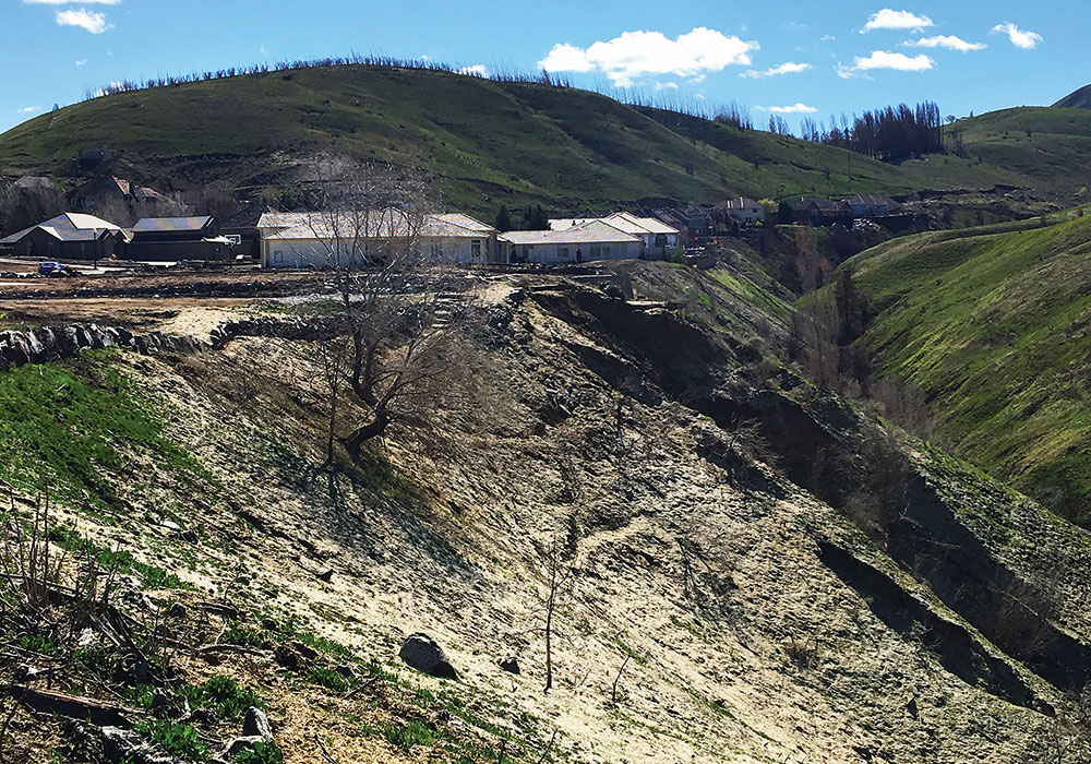
Following the 2015 Sleepy Hollow Fire in Wenatchee, Washington, affected residents of the Broadview neighborhood were required to increase setbacks from the slope to maintain adequate defensible space and reduce risk from slope instability. Photo by Molly Mowery.
Such conversations have helped her to communicate with the general public about the risks inherent in certain development patterns: "If we're going to be sending first responders into an area, it's important to understand what they need to be safe and to protect structures efficiently."
The concept of cascading hazards itself can be helpful in swaying public opinion, Mowery adds. "I don't want to sound like I'm antidevelopment or antigrowth, but when a community is looking at where to allow new development, it can strengthen the case if it's not just one hazard, but a discussion of what may be multiple hazards that structures would be subject to. Explaining how one hazard may precipitate or exacerbate other hazards is one of the ways we try to communicate the risks to elected officials."
Yet she acknowledges that where development already exists, there are no easy solutions to stopping the domino effect — not just because of landowner opposition, but because of the unpredictability of the hazards themselves. "There are certainly strategies, but there's probably a limit to all the different scenarios of cascading hazards that a community can realistically plan for. There's only so much that's feasible. That's the hard truth of this."
Brian Barth is a freelance journalist with a background in urban planning. He lives in Toronto.
Planning for Cascading Hazards
The "Snowball Project" developed by the European Union compares the way communities usually write hazards plans and what needs to happen in order to develop a plan that accounts for cascading risks.
| Hazards Plan | Multi-Hazards Plan |
|---|---|
| 1. Definition of the space-time window for the risk assessment and the metric for evaluating the risks. | 1. Definition of the space-time window for the cascading effects scenario assessment and the metrics for evaluating the impact on selected elements at risk. |
| 2. Identification of the risks impending on the selected area. | 2. Identification of the triggering hazards impending on the selected area. |
| 3. Identification of selected hazard scenarios covering all possible intensities and relevant hazard interactions. | 3. Identification of selected cascading effects scenarios covering all possible chains of events and relevant hazard interactions. |
| 4. Probabilistic assessment of each hazard scenario. | 4. Probabilistic assessment of each cascading effect scenario, assuming the occurrence of a triggering hazard with a given magnitude. |
| 5. Vulnerability and exposure assessment for each scenario, taking into account the vulnerability of the exposed elements to the combined hazards. | 5. Vulnerability and exposure assessment for each scenario, taking into account the dynamic vulnerability of the exposed elements to the chain of hazards (including the influence of time and human behavior factors). |
Source: International Journal of Disaster Risk Reduction
Isle de Jean Charles
A Case Study in the Inequitable Outcomes of Multi-Headed Hazards
In the 1930s, several million people left Oklahoma and other states impacted by the "Dust Bowl" — a classic example of a cascading hazard, in which intersecting forces of drought, unwise agricultural practices, and economic collapse produced one of the largest migrations in American history. The "Okies," as they were often called, were not treated kindly when they arrived desperate for work in places like California.
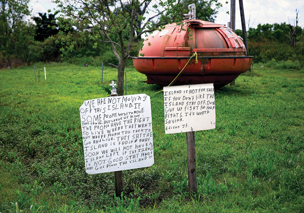
Photo by Josh Hander/The New York Times.
Alessandra Jerolleman, a hazards planning and disaster mitigation expert in Louisiana, fears a similar scenario is beginning to play out in communities vulnerable to climate change. Jerolleman has worked extensively with the low-lying Louisiana community of Isle de Jean Charles, home to a band of Biloxi-Chitimacha-Choctaw Indians, which has lost 98 percent of its land (once 32,000 acres) to the Gulf of Mexico. Another tribe, the United Houma Nation, also claims the island as its historical homeland. Here the cascading hazards of sea-level rise and hurricanes have been exacerbated by land subsidence (largely the result of a century's worth of sediment stuck behind flood control structures upstream in the Mississippi basin) and the loss of coastal wetlands (mostly caused by oil and gas development in the region). The ever-present threat of oil spills — Isle de Jean Charles was on the front line of the Deepwater Horizon spill — makes the tribe's situation even more precarious.
"Who is bearing the burden of moving?" Jerolleman asks. "It's the tribe. Where did the risk come from? It came from things like oil and gas development, where the primary beneficiaries of the risk-creating activities are not the ones that now bear the burden of adapting."
The state of Louisiana received a $92.6 million grant in 2016 as a result of the competitively awarded, HUD-sponsored National Disaster Resilience Competition. Of that, $48.3 million was specifically dedicated to the Resettlement of Isle de Jean Charles. The funding is aimed at building a new community about an hour's drive inland, with an understanding that it not be designed as a conventional subdivision but would make an attempt to provide a culturally relevant lifestyle to a group whose members had until recently subsisted largely from backyard gardens and seafood sourced from nearby estuaries. Land has been purchased and construction is set to begin — but the planning process has fallen apart, according to outsiders familiar with the project but not part of the official State of Louisiana project team. Recent reports from other media sources are that most tribal members have elected not to accept the resettlement offer because they feel the intent of creating a culturally relevant community has not been upheld.
Economic inequities are also in play, explains Jerolleman. "The most recent proposal says that if tribal members accept a house in the new development, it would require a lien on their property on the island. And if they ever defaulted on the insurance or property taxes" — expenses many in the impoverished community do not currently have to pay — "they would potentially lose both their new home and access to the island, which is sacred land."
The Isle de Jean Charles tribe is descended from Native American groups who were forced off their land during the Trail of Tears, and found refuge in southern Louisiana instead of being marched to Oklahoma. Now they are poised to become the nation's first climate refugees, but they will almost certainly not be the last — yet a resettlement process that was intended as a model for other communities risks replicating past injustices, says Jerolleman, who recently published a book titled Disaster Recovery Through the Lens of Justice.
"Sometimes what happens in disaster recovery is actually a disaster in and of itself with very profound and inequitable impacts for those communities that are left out and are then at greater risk from the next event," she says.
"When it comes to the idea of cascading hazards, I don't often see a willingness to look back very far, and I think that's a disservice. History matters," she says. "When we look at the spatial distribution of risk and vulnerability — policies around redlining, around where highways were put — all of these kinds of things helped to create the landscapes of risk that are currently in play. In terms of climate adaptation, if we only look forward in how we plan for the interactions between hazards, and fail to also look back, we run the risk of creating some very serious justice issues."
Correction: An earlier version of this story incorrectly reported the funding specifics for this project and failed to mention that two tribes, not one, claim Isle de Jean Charles as historical homelands. It also failed to cite a source for the assessment and subsequent commentary indicating the plan has “fallen apart.” The article posted here reflects those changes and corrections.


