Planning October 2019
Virtual Horizons
Four trends in immersive technologies that are redefining the planning and design process.
By Becky Zimmermann, AICP, and Anna Dillé, LEED Green Associate
Technology is changing our profession at an astoundingly rapid rate. Who would have imagined just five years ago that planners and landscape architects would be using immersive technologies like virtual reality on a regular basis?
VR, as defined by the Virtual Reality Society, is a three-dimensional, computer-generated environment that a person can explore and interact with — and actually become a part of — allowing them to experience that generated environment as if they were actually there. By applying VR to urban design and planning, planners and landscape architects can immerse ourselves, our clients, and external stakeholders in proposed designs at any stage in the planning or design process, which has a multitude of benefits.
Though VR has been around for decades, until recently the technology's adoption was hindered by prohibitive costs and the high levels of technical expertise required to operate it. Over the last two years, however, those barriers to adoption have begun to fall. As a result, VR is fast becoming an integral tool in the planning and design toolbox — one that in the not-so-distant future could fundamentally change the urban planning and design process as we know it.
Four VR uses in planning
Here are four major ways VR is being used in the work of planners and landscape architects today.

It's hard to imagine a parking lot under a viaduct as a vibrant park. That's where VR comes in. Image courtesy Design Workshop, Inc.
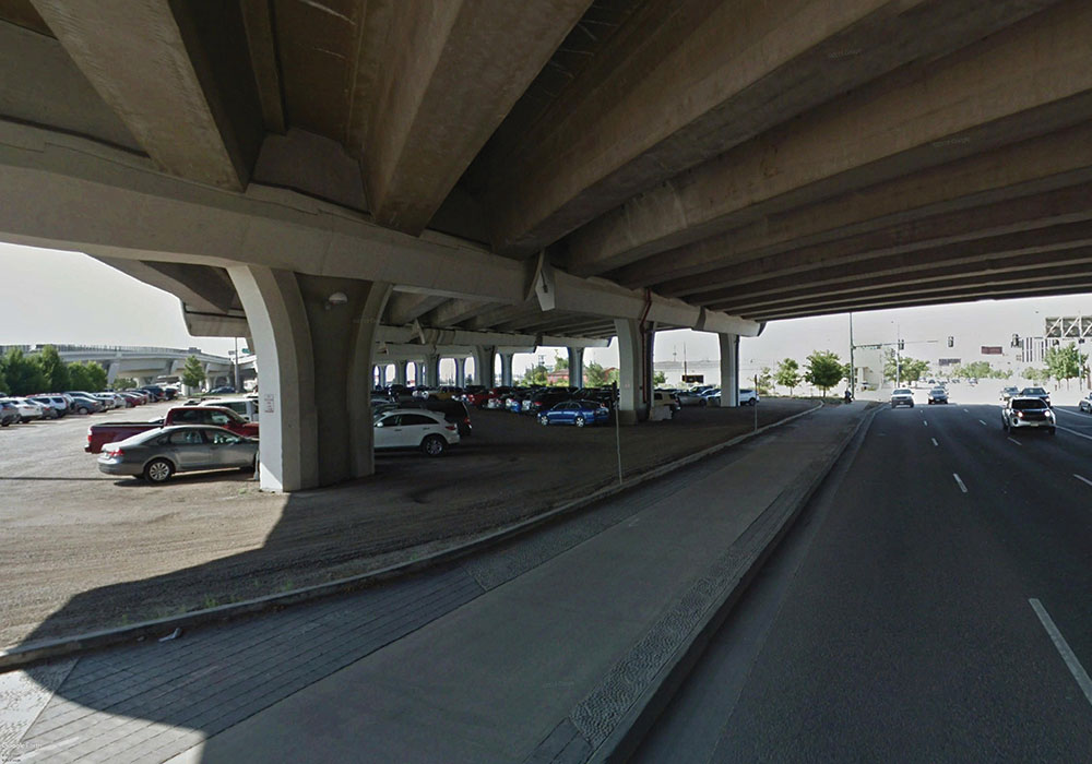
The parking lot today. Image from Google Earth.
1. INFORMING THE PLANNING AND DESIGN PROCESS.
Planners, particularly planning consultants working with clients, can start using VR at the very beginning of a project to study creative ideas, analyze how spaces feel, and make decisions in real time. VR technology also is a powerful tool for communicating ideas more clearly to internal and external stakeholders, as well as encouraging collaboration.
A three-dimensional experience communicates differently than two-dimensional plans, drawings, and illustrations, offering perspective that answers important questions like what the space will feel like, how wide it will be, and how tall something is. This allows planners and designers to reduce client confusion, identify potential issues, solve problems, accommodate stakeholder needs early, and potentially avoid having to make major adjustments once construction or implementation starts.
That was certainly the case in the redesign of the Meadows Town Center in Castle Rock, Colorado — a master-planned community located 30 minutes from Denver and 45 minutes from Colorado Springs. Because of the high-profile nature of the plaza within the community, our firm, Design Workshop, suggested the client use VR to help explain the design to the community's ownership group and the neighborhood association that would ultimately manage the plaza once completed.
The consultant team conducted two viewings with the client group: the initial design at the consultant's office using a fully immersive VR setup and the final design at the client's office using a mobile VR setup. A number of changes resulted from the VR experience — alterations that would have been challenging to adjust at later stages of development.
Certain walls were shifted two feet away from the sidewalks and the heights of the walls themselves were lowered to allow people to sit on them. VR also revealed how shadows cast by the pavilion — a major focal point of the plaza — would move across the plaza according to the time of day, helping the team decide that moveable tables and chairs were better than fixed seating.
Case Study: The Multiple Scales of Using VR


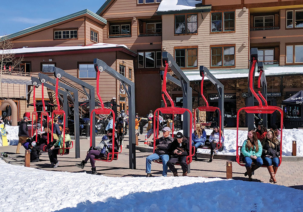
Images courtesy Design Workshop, Inc.
The 25-year-old plaza at the base of Winter Park Resort in Colorado needed to be replaced in 2015. The Winter Park Village Master Association had two choices: They could tear it up and reconstruct what was there before, while adding a snowmelt system in the process. Or they could take advantage of a once-in-a quarter-century opportunity to improve circulation, engage retail storefronts, and create gathering and event spaces. Estimates for the second option came in $1.8 million — more than twice the cost of replacement.
The plan — and its budget — required the approval of more than 400 members of the Community Owners Association. At the annual homeowners meeting, Design Workshop set up a VR station with a gaming laptop, tripods to virtually define the borders of the site, headsets, and a large monitor so others could watch what the viewer wearing the headset could see. It allowed residential and business owners to see what the redesigned plaza would look like, how it would feel, and how it would function. Owners of condo units were even able to "look" at the proposed plaza (above, left) from their balconies. Ultimately, 94 percent of them voted to approve the $1.8 million plaza redesign budget.
The design team used VR at a detail scale as well. Embracing its adjacency to the ski resort, the plaza design incorporated nine swings made from chairlift seats. Designers modeled and virtually tested 50 different types of swing options before settling on the final design (center). The virtual review process streamlined collaboration as stakeholders offered feedback via live mark-up and comments. For their part, fabricators also gave feedback in the virtual space, commenting on the constructability of the swing designs, which significantly shortened the production process.
Today, the chairlift swings (above right) are Instagram gold and weekly Snowga (snow yoga) classes take advantage of the snow melted surface, freshening the image of the resort. "Virtual reality was a game-changer," says Kelly Mace, director of lodging and association management. "There are so many stakeholders associated with this plaza. VR allowed them to see the benefits of design. They knew exactly what to expect, and they are really happy with the outcome.
2. ENHANCING THE VISION.
Design concepts, especially those that are far reaching and visionary, can be hard to communicate. VR allows planners and designers to take complex ideas and show people how it will impact their reality, making it a critical tool in demonstrating the value and benefits of projects and designs that push the envelope.
In Denver, Design Workshop worked on the design of a large-scale transportation improvement project along the South Broadway corridor. A major transportation corridor, Broadway runs underneath Interstate 25. Also beneath the viaduct is a gravel parking lot serving the South Broadway Regional Transportation District light-rail station.
As an alternative to this area remaining as a parking lot, the consulting team proposed to the project partners — the city, the Colorado Department of Transportation, and RTD — that the lot become an artful, fun, edgy park. The proposal, presented in the fall of 2017, was complex and challenging to communicate to the project stakeholders.
The city struggled to see the true potential of this forgotten space, which is where VR came in. City officials and park leadership each took their turn with the VR headset and hand controls, freely navigating through the design, mimicking the same circulation routes that transit users and other community members would use, and experiencing the variety of active uses being planned for the park.
The experience gave city leaders and planners an understanding of how transformative this park could be, and actually turned them into major advocates for the park's inclusion in the project.
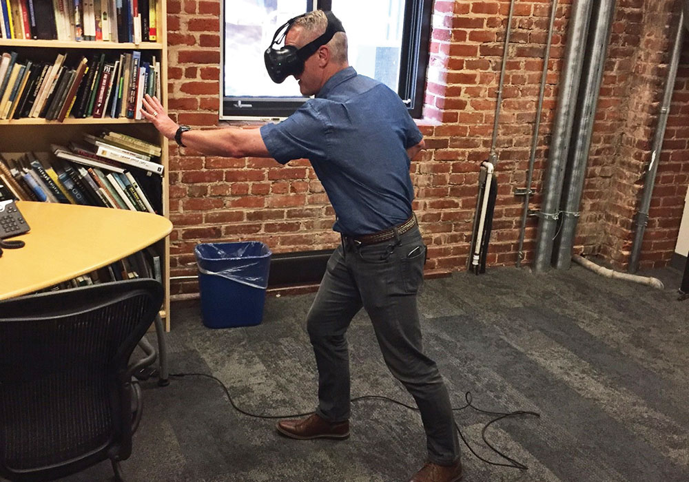
A VR user takes his turn exploring the concept for Broadway Viaduct Park in Denver — moving through the space, navigating the design, and mimicking the path transit users and pedestrians would use. Photo courtesy Design Workshop, Inc.
3. DRIVING ENGAGEMENT.
Getting project or plan buy-in — from stakeholders, community members, governments and developers — is essential but often difficult.
VR can be very useful for engagement. Helping stakeholders to see what a new park or plaza will feel like is one of the best tools for gaining support, soliciting informed feedback, and even garnering financial resources.
That was the case In Lafayette, Louisiana. Back in the early 2000s, a 100-acre property formerly known as the University of Louisiana's "Horse Farm" was threatened by extensive commercial development. In 2012, the Lafayette Consolidated Government purchased the land from the university and worked with the newly formed nonprofit Lafayette Central Park, Inc., to create and maintain a new park. Now known as Moncus Park, it was planned and designed through intensive community engagement, and funding came from a variety of sources, including philanthropic gifts.
The first phase, with a projected cost of $6 million, is under construction and is set to open in early 2020. Earlier this year, when LCPI began seeking financial support for the next phase of design — a farmers market, pavilion, and plaza — the nonprofit used VR to allow potential donors to virtually walk through the space, which the organization believes will result in significant donations and ongoing support for the development of the park.
4. ADVANCING HIGHER EDUCATION AND RESEARCH.
Within the past few years, several landscape architecture and planning degree programs have adopted VR into their curriculums and research methods.
At Utah State University, Benjamin George, assistant professor of landscape architecture and environmental planning, introduced VR in 2016 to help his students gain a better understanding of large, landscape-scale design projects. George uses drone-captured imagery to create a 3-D model of a landscape. Students interact with the landscape in VR, and design on top of it, taking into consideration the physical and spatial context of the site by "being there."
The VR environment offers students a unique awareness of space that allows them to make design decisions immediately, while also learning valuable skills.
Recently, George and three graduate students used projects from technology companies Intel and Puget Systems to create a conceptual plan for Powder Mountain Resort in Utah. The team of students flew a drone over 600 acres of the mountainside to create accurate terrain data to inform the design and create — and try out — various concepts for the future resort. The student's final design reduced the footprint of Power Mountain's previous design and created open space corridors within the village, all while retaining the client's preferred density.
Researchers at North Carolina State University used VR to explore different types of urban green spaces. The team captured 360-degree, high- resolution images of a neighborhood park and downtown plaza in Raleigh and created different environments with varying vegetation. VR helped the researchers understand the impacts of each landscaping scheme on virtual visitors, concluding that significant vegetation surrounding the downtown plaza created a sense of refuge by shielding visitors from a busy urban environment. Conversely, in the neighborhood park, people disliked feeling enclosed by vegetation and actually felt unsafe.
Building Your VR Experience
A VR system can be an inexpensive 360 Panorama headset or a sophisticated (and pricey) interactive, first-person experience for multiple users. Here are some suggestions from Design Workshop and an idea of how much each system could cost.
Low Range: <$10

HARDWARE: desktop computer (i.e., Dell Precision T5810, 2gb graphics), mobile phone
HEADSET: DIY or cardboard visor
SOFTWARE: Symmetry (freeware)
Mid Range: <$4,000
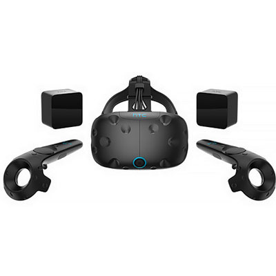
HARDWARE: Gaming laptop ($2,500)
HEADSET: HTC Vive headset with sensors ($600)
SOFTWARE: Steam VR ($800)
High Range: $10,000+
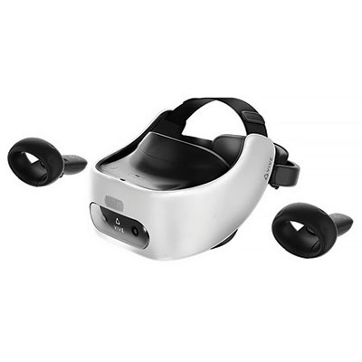
HARDWARE: Gaming laptop ($2,500)
HEADSET: HTC Vive Focus with wireless multiuser environment ($1,000 each)
DRONE: $3,000
SOFTWARE: IrisVR ($2,700)
| 360 Panorama: Mobile Headset (powered by mobile phone) | Interactive First Person: Computer Headset (powered by computer) |
|---|---|
| Limited quality display | High-quality display |
| Static: experienced only as a passive bystander in VR | Motion tracking: immersive; viewer can actively walk around |
| 1 controller, used for navigation | 2 controllers, can interact with objects in VR |
| High portability, including headset. Setup time: 5 seconds | Limited portability: uses computer, headset, controllers, and sensors and needs access to 4 power outlets. Setup time: 20 minutes |
| High shareability: cloud storage; any device can share and view | Limited shareability: can only share to another computer with access to a computer headset |
The future of VR
As VR technology becomes even more cost-effective and easier to use, we can expect to see many more innovative uses for the technology, and proven results will support increased usage.
Within just the next few years, VR will completely redefine immersive analytics — a multidisciplinary initiative that seeks to take data visualization to the next level. VR plug-ins will incorporate environmental data (i.e., where light shines in the morning or afternoon, sunbeams, etc.) and human behavior (e.g., where a person's eye is drawn to). By simplifying this complex data into a form planners and designers can readily use and apply, this technology could become essential for urban planning. Combine VR with augmented reality and other mobile technology, and the applications of VR are almost limitless.
So tighten your headset straps, planners. It's going to be an exciting ride.
Becky Zimmermann is president of Design Workshop, a design firm specializing in landscape architecture, urban planning, and strategic services. Anna Dillé, also with Design Workshop, is an urban designer and visual communications specialist with experience in public spaces and parks, urban design, master planning, resort design, transit-oriented development, and mixed-use development.


